Ground & Airborne Geophysical Survey Services
From survey design to 3D modeling, Dias provides a full solution for our clients. Starting with a broad range of unique and differentiated survey solutions, Dias delivers rich, high-volume data sets for better results. Dias provides ground DCIP, MT, CSAMT and AMT surveys with its DIAS32 system, and airborne FTMG and MT surveys with its QMAGT and QAMT systems, respectively.


Dias improves geophysical surveying by modernizing the technologies that bring value to our clients and the problems that they solve.
We specialize in 3D ground resistivity and induced polarization surveys that are easier to deploy, more efficient to execute, easier to customize around inaccessible or challenging terrain, and can acquire high-quality, low-noise, and high-volume data sets.
As this technology has been continuously updated and improved throughout our years, we have expanded into other ground surveying, including ground magnetotellurics (MT), as this can easily be acquired in conjunction with 3D IP and resistivity surveys and provides a highly complementary dataset for mineral exploration objectives.
Airborne Geophysical Surveys


Dias Airborne delivers two airborne surveying systems.
With the modernization of medical imaging technologies through quantum computing and low temperature SQUID (Superconducting Quantum Interference Devices) sensors, Dias has seen an opportunity to partner with Supracon AG to adapt and bring this technology to the airborne industry. The result is stunning capability to pick up fine details in the earth, and this gives our clients the flexibility to fly fewer flight lines over their project area for the same quality result as conventional surveying (thereby requiring less helicopter time), or to obtain exceptional resolution results by using tighter spaced flight lines. Areas with highly complex near-surface geology is one example of projects that can benefit from this sort of resolution.
Dias Airborne provides two airborne surveying systems: A full-tensor magnetic gradiometry system (QMAGT), which measures every tensor component of the magnetic field. These surveys provides every detail of the magnetic field. The full-tensor measurements of the magnetic field give a complete description of the magnetic response of the earth.
3D IMAGING – Effective 3D Imaging for a 3D Earth
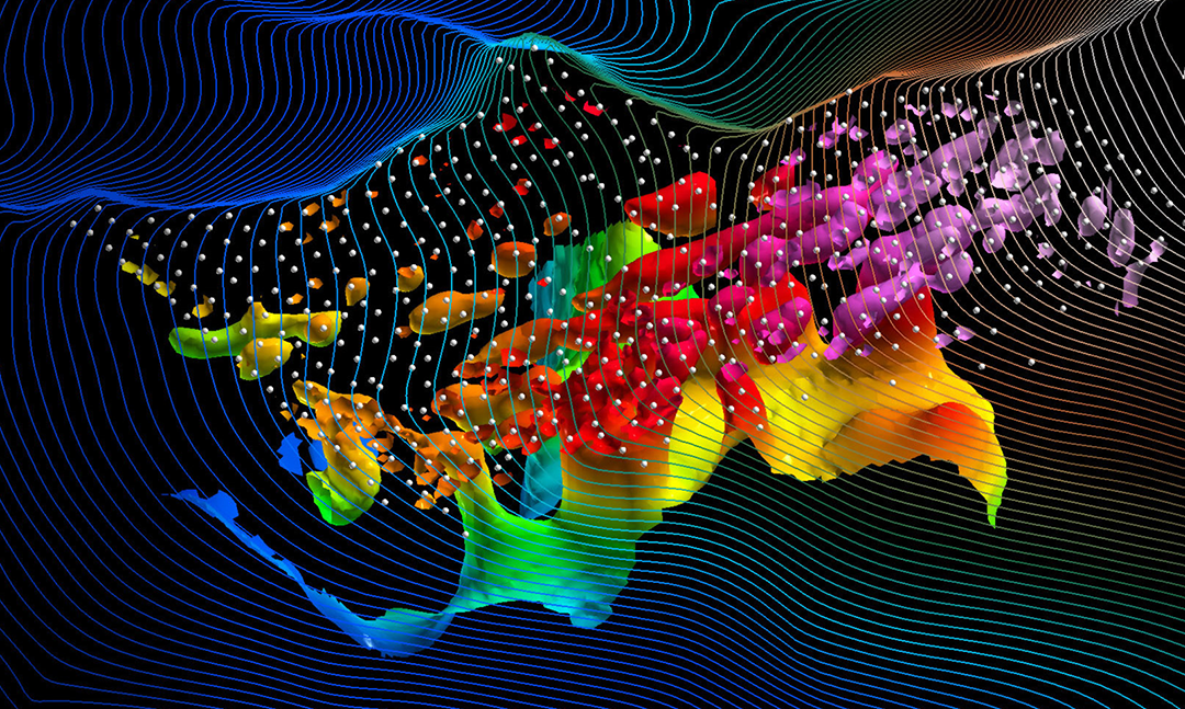


Most of the surveys that Dias performs support robust 3D models. Through collaboration with the SimPEG inversion group, Dias has developed robust and efficient routines for the generation of accurate 3D model for all of its survey types. These models can be displayed in any standard 3D package for visualization, integration and interpretation with other 3D data sets.
Survey Design

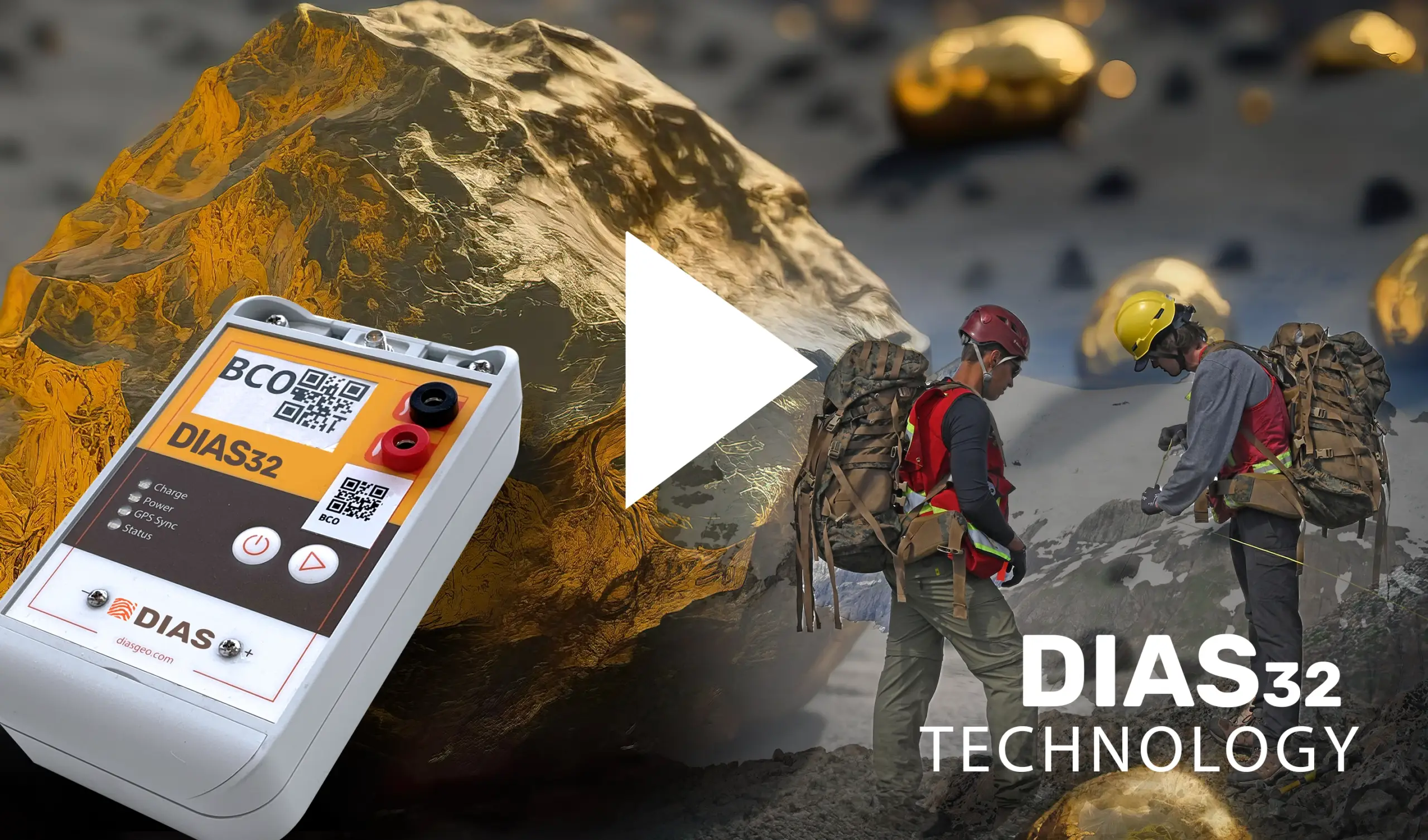

We specialize in 3D ground resistivity and induced polarization surveys that are easier to deploy, more efficient to execute, easier to customize around inaccessible or challenging terrain, and can acquire high-quality, low-noise, and high-volume data sets.
As this technology has been continuously updated and improved throughout our years, we have expanded into other ground surveying, including ground magnetotellurics (MT), as this can easily be acquired in conjunction with 3D IP and resistivity surveys and provides a highly complementary dataset for mineral exploration objectives.